2024-12-13 04:48:36
Navigation
MAPS

We are recommending

Exhibition

Exhibitions

Exhibition

News
06 JUN 2013
Estonian Inter-war maps New information and maps supplemented chapter of 2-verst (1:84000) maps of Russian Empire, chapter of German First World war period maps maps in scale 1:126000 (3-werst per inch) "Karte Europaisches Russland 1:126000" and chapter of Inter-war (1918-1940) Estonian maps. Interesting that Estonian topographers 1918-1922* republished series of Russian verst-scale (0.5, 1, 2. 3- verst maps) maps practically without changes in content (generally place-names were translated into Estonian).
· admin on 2013-06-06 20:17:57 · Read More · 2159 Reads · Print
28 MAY 2013
Geological map of Germany Updated chapter of Austrian maps (Map of European and Asian part of Russia, 1820, 1:2200000) and chapter of German atlases (Geognostic (geological map prototype) map of Germany and adjacent countries on 42 sheets, 1826, 1:1100000).
· admin on 2013-05-28 15:57:37
Read More · 2070 Reads · Print
20 MAY 2013
Atlas of Poland anf Lithuania Section of Polish WIG maps (1919-1939) was supplemented by Vilnius (Kirtimai) airport plan (1:20000, 1932) and decription of the airport. It is interesting that in 1933 from Vilnius LOT plane had flights to Warsawa and Riga ... In the same section updated information about operational WIG 1:300000 scale maps, as well as information about the Polish administrative map in scale 1:300000. At the section Polish maps (1770-1939) we presenting set of maps showing Poland - Lithuania battles in 1920 (all maps can be downloaded)...
· admin on 2013-05-20 20:17:42
Read More · 2115 Reads · Print
13 MAY 2013
1:25000 index We started new chapter Original index sheets of Inter-war Lithuania maps. There will be presented all known index sheets of Inter-war Lithuania maps (scans, scale 1:25000, 1:100000). Also new information supplemented chapter of Inter-war Lithuania maps in scale 1:5000. Maps were created enlarging 1:25000 maps.
· admin on 2013-05-13 20:25:43
Read More · 2125 Reads · Print
05 MAY 2013
O-35-122-D New information supplemented chapter of set WWI German maps Ubersichtskarte von Europa und Vorderasien 1:800000 (Overview map of Europe and Middle East in scale 1:800000) and set of WWII German maps Ostland 1:50000 (set covers territories of present Estonia, Latvia, partially Lithuania).
· admin on 2013-05-05 20:34:57
Read More · 2150 Reads · Print
28 APR 2013
Map of Great Lithuania Upgraded chapter of Single maps of inter-war Lithuania (1918-1940), also updated chapters of 1-verst (1:42000), 2-verst (1:84000), 3-verst (1:126000) and 10-verst (1:420000) maps of Russian empire. General chapter Russian maps (1790-1917) supplemented by new information showing augment newest survey done by topographers of Russian empire (till 1917).
· admin on 2013-04-28 21:25:30
Read More · 2054 Reads · Print
19 APR 2013
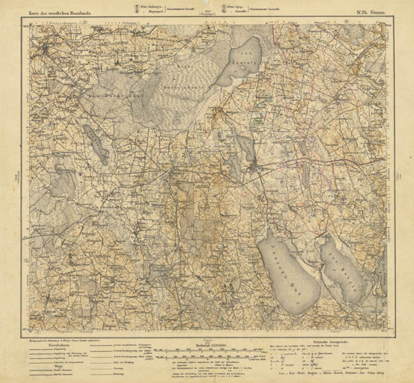
Karte der 8 Armee Marveling at the German cartographers productivity, we added to the chapter of First World War era German maps in scale 1:100000 description of 8 Army's area (now Latvia, Estonia and Lithuania territories) maps in scale 1:100000 named Übersichtskarte der 8 Armee (8 Army Survey map). Also chapter of maps Karte des Westlichen Russlands (Western Russia map, 1:100000) supplemented by new information.
· admin on 2013-04-19 16:15:18
Read More · 2154 Reads · Print
12 APR 2013
Map of Siedlce Poland News at chapter Maps of Russian Empire in scale 1:42000 (one verst per inch) orig. named Одноверстовая карта западного пограничного пространства (1-verst maps of west border space). From now at this chapter you can ask (contacts) fragment of map with interesting city. Also updated chapters of German First World War era maps Karte Europaisches Russland 1:126000 and Feldmassig hergestellte Fliegerkarte (1:200000, Map to aviators).
· admin on 2013-04-12 10:16:42
Read More · 2090 Reads · Print
04 APR 2013
Karte von Kurland Chapter of First World War era German maps in scale 1:50000 Karte von Kurland (Kurland map) was revised and supplemented by new information. Maps from this set cover big part of Latvia and the northern territory of Lithuania. Also updated description of WWI period German maps in scale 1:25000 Russischen karte des Westlichen Grenzgebiets (Russian map of western frontier).
· admin on 2013-04-04 20:37:23
Read More · 2023 Reads · Print
29 MAR 2013
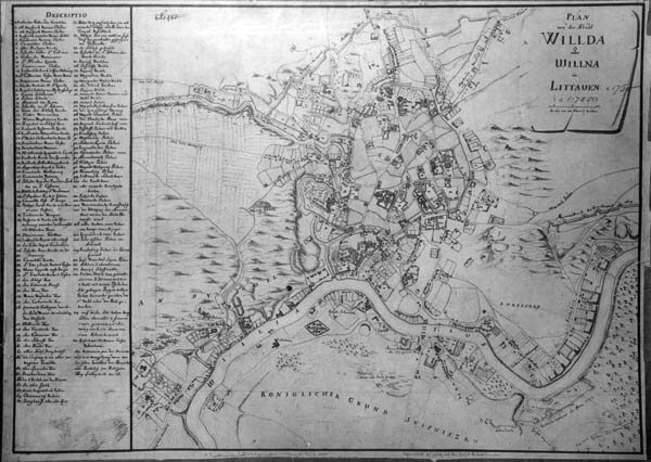
Wilno 1740 And a little more about Vilnius. Chapter of WIG maps supplemented by information about Plan of city Vilnius (original name in Polish - Plan miasta wielkiego Wilna) in scale 1:2500, 1938 (47 sheets). Virtual maps4u.lt' exhibition Capital of Lithuania Vilnius on topographic maps and plans (XVII-XX c.) supplemented by new plan prepared by Johann Georg Max Fürstenhoff  Plan von der Stadt Wilda oder Willna in Littauen, 1737 (1740).
· admin on 2013-03-29 16:52:28
Read More · 1897 Reads · Print
23 MAR 2013
Karte des Westlichen Russlands We updated description of the collection of German maps in scale 1:100000 from  WWI period, Karte des Westlichen Russlands (map of western Russia). Maps of this collection were mainly made ​​using 2 versts (1:84000) map of the western border area of ​​the Russian Empire. New information supplemented section Atlases of the Russian Empire.
· admin on 2013-03-23 20:41:54
Read More · 2069 Reads · Print
Languages, Kalbos, Языки
I like maps4u.lt
Login
Username

Password


Not a member yet?
Click here to register.

Forgotten your password?
Request a new one here.
Google
Counter
Hey.lt - Nemokamas lankytojų skaitliukas
Render time: 0.05 seconds 3,906,075 unique visits