|
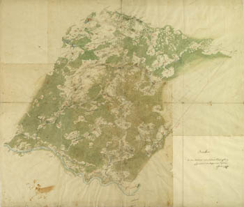
Survey of West Gallicia, 1801-1804, index sheet.
|
|
Example of original (sheet Nr. 207, see index sheet) of survey of West Gallicia (1801-1804)
Example of original (sheet Nr. 207, see index sheet) of survey of West Gallicia (1801-1804) in scale 1:28800.
|
|
Carte von West-Gallizien, 1:172800, 1808.
Using survey of West Gallicia (1801-1804) in 1808 was published set of maps of West Gallicia in scale 1:172800 originally named Carte von West-Gallizien: welche auf allerhochsten Befehl Seiner Kaiserlich Oesterreichischen und Koeniglich Apostolischen Majestat in den Jahren von 1801 bis 1804 unter der Direction des dermahligen General Majors, und General Quartiermeisters Anton Mayer von Heldensfeld [...] durch den Kaiserl. Koenigl. Generalquartiermeisterstaab militarisch aufgenommen worden... / gezeichnet, und gestochen von Hieronimus Benedicti. Set consists of 12 maps (each size 47x69 cm.).
The big picture of map of West Gallicia in scale 1:172800, 1808. ( THERE is coverage of maps) |
|
Austrian Maps (1790-1800), scale 1:72000 (creators Osterlamm, I.G.Metzburg) in West Galicia
After Third partition of Poland and Grand Duchy Lithuania (1795) Autrian topographers began survey on territories of Poland which come to Austria. Team supervised by Ignaz Georg von Metzburg in years 1796-1799 made survey of West Galicia (Galicja Zachodnia) - territories between rivers Bug and Wisla and Pilica. Survey was based on triangulation. Outcoming this was created set of maps of West Galicia in scale 1:72000 and 1:144000. Maps in scale 1:72000 have dimmension appr. 63x47 cm, draw in colour on paper.

General view of map from set West Galicia (Galicja Zachodnia) created by Ignaz Georg von Metzburg 1796-1799, scale 1:72000. Sheet with cities Garwolin, Laskarzew, Ryczywol, Magniszow
Also available sheets Number 14 (Polaniec, Bogoria, Klimontow, Sandomierz), Number 35 (Zwolen, Gniewoszow, Sieciechow, Wargoczyn).
Parallel to team supervised by Ignaz Georg von Metzburg on territories of West Galicia worked team of Austrian topographers with leadership by Osterlamm. Colored maps created by Osterlamm (mostly 1796) have dimmension 60x40 cm, scale 1:72000, but different orientation as maps created by Ignaz Georg von Metzburg.
General view of map prepared by Austrian topographer Osterlamm (1796, scale 1:72000). Map covering Garwolin, Latowice, Zelechow, Wargoczyn.
Also available map from this set covering Zwolen, Gniewoszow, Sieciechow, Wargoczyn, Golab.
Literature: Sawicki L. Pulkownika Antoniego barona Mayera Holdensfelda zdjecie topograficzne w Polsce w latach 1801-1804, 1928.
Keywords: Ignaz Georg von Metzburg, West Galicia, Osterlamm, 1:72000, Galicja Zachodnia, mapa Ignaza Georga von Metzburga, Westgalizien.
|
|
Theatre of war between France and Russia (1812). Kriegs - Theater zwischen Frankreich und Russland (1812).
Map of Theatre of war between France and Russia (1812, in original Kriegs - Theater zwischen Frankreich und Russland), prepared by autrian topographers in Vienna. Scale of map 1:1700000, size - 113x112 cm (large map). Map shows territories of former The Polish–Lithuanian Commonwealth during Napoleonic wars. Publisher - Artaria und Comp.
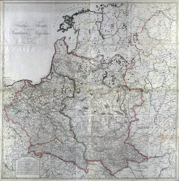
Map of Theatre of war between France and Russia (1812, in original Kriegs - Theater zwischen Frankreich und Russland). Full size map (link)
|
|
Map of Middle Europa (1807-1813), 1:650000
Austrian topographers, led by Joseph Marx Freiherrn von Lichtenstern (1765-1828), in 1807-1813 in Vienna (Austria) has released the Map of Middle Europe in 64 sheets (original title Charte der von Mitteleuropa in 64 Sectionen entworfen, von Joseph Marx Freiherrn von Lichtenstern), which six (6, 7, 8, 14, 15, 16) sheets represented the current territory of Lithuania (see index sheet below).
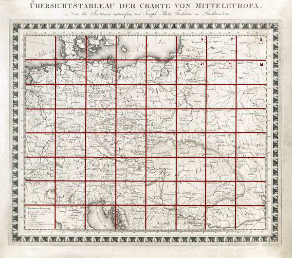
Index sheet of Map of Middle Europe in 64 sheets (original title Charte der von Mitteleuropa in 64 Sectionen entworfen, von Joseph Marx Freiherrn von Lichtenstern)
Scale of index sheet - 1:7400000, size 31x37 cm. Scale of separate maps - 1:650000, size 31x36 cm. Maps prepared and issued in 1807-1813 according to the latest cartographic material. Map sheets numbered in Roman numerals on margins name of set, the map author and drawer, the year of issue given. Maps content displayed in one color, relief displayed by shading.
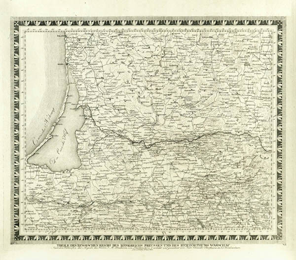
General view of VI map of Map of Middle Europe in 64 sheets (original title Charte der von Mitteleuropa in 64 Sectionen entworfen, von Joseph Marx Freiherrn von Lichtenstern), 1810
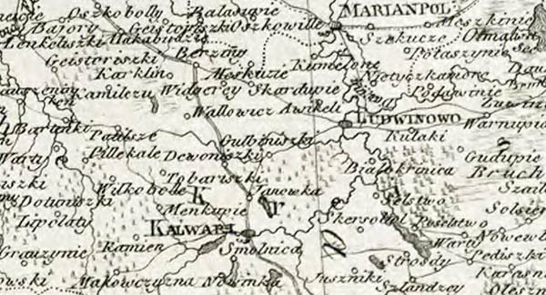
Fragment of VI map of Map of Middle Europe in 64 sheets (original title Charte der von Mitteleuropa in 64 Sectionen entworfen, von Joseph Marx Freiherrn von Lichtenstern), 1810, part of Lithuania (city Kalvarija and surroundings)
|
|
Map of European and Asian part of Russia, 1820, 1:2200000
Map of European and Asian part of Russia (original name in German and French - Carte Des Europaeisch - und eines Theils des asiatisch-russischen Reichs: nach den neuesten astronomischen Ortsbestimmungen, den grossen Atlas und andern karten des russisch - Kaiserl. Karten-Depots verfasst..., žemėlapio pavadinimas pateiktas ir prancūzų kalba Carte de la partie européene et asiatique de L'Empire de Russie: avec lindication des chemins et routes de Postes...) published in 1820 in Vien. Set consists of 12 maps in scale 1:2200000 and combined into one lage map (dimmensions 154 x142 cm). Maps prepared using newest in this time Russian cartographic material. Longitude considered from Ferro. Creator Ivan Danielov, publisher Artaria und Compagnie.
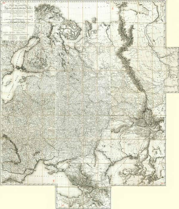
General view of Map of European and Asian part of Russia (original name in German and French - Carte Des Europaeisch - und eines Theils des asiatisch-russischen Reichs...) 1820.

Fragment of Map of European and Asian part of Russia (original name in German and French - Carte Des Europaeisch - und eines Theils des asiatisch-russischen Reichs...) 1820, territory of Lithuania
|
|


