2024-03-19 12:14:44
Navigation
MAPS
· ATLASES

We are recommending

Exhibition

Exhibitions

Exhibition

1:42000 (1-verst maps)
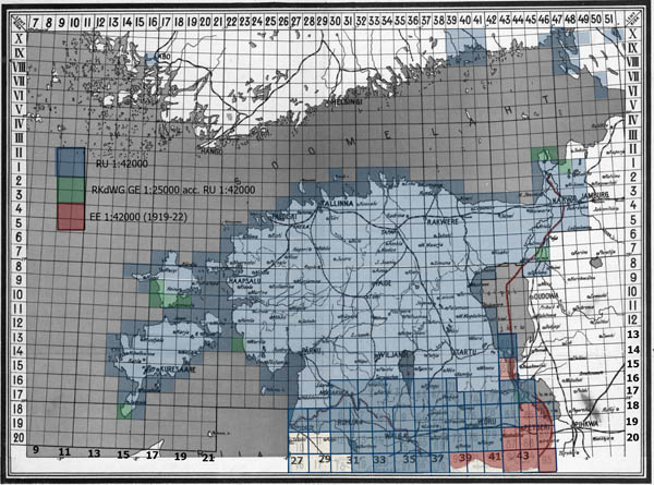
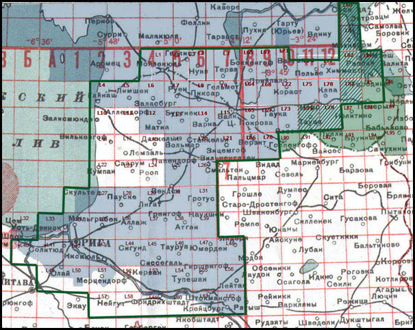
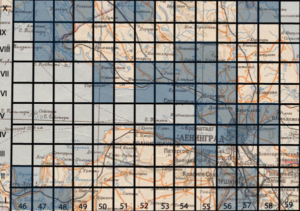
Index sheet for maps in scale 1:42000 (one werst map) of Russian empire (1880-1917), link

Maps of Russian Empire in scale 1:42000 (one verst per inch) orig. named Одноверстовая карта западного пограничного пространства (1-verst maps of west border space) were prepared and published from 1880 till First World War (WW I), topographers of Red army maps in scale 1:42000 republished till 1930-1940 (some updates were made).

Maps in scale 1:42000 (one werst map) were assembled from four double reduced photocopies of maps in scale 1:21000. The contents of the map in scale 1:42000 and 1:21000 identical, differ only in the font size and thickness of lines. Maps were printed monochrome without changes in the content. Later editions (up to 1930's), especially the eastern sheets, were printed in four colors, some updates were made. Maps in scale 1:21000 and 1:42000 have identical format (in the reissue were exceptions). Extent -18' longitude and 10' latitude (central zone) and 12' longitude and 16' latitude (Noth zone). Longitude was considered from Pulkovo.

Map scale 1:42000 (central zone) numbered Roman and Arabic numerals or letters. First - Roman - indicates the number of latitude's line, the second - Arabic number or letter - indicates position sheet in row. By the number of maps placed name of the largest settlement (see index sheet above).

Map scale 1:42000 (north zone) numbered Roman and Arabic numerals. First - Roman or Arabic - indicates the number of latitude's line, the second - Arabic number - indicates position sheet in row (see index sheet below).

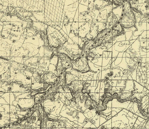
On the frames of maps in scale 1:42000 are specified points of minute grid, year of surveying and updating of maps, marked linear kilometer and werst scales. On some pages is a list of triangulation points.

Comparison of verst scale maps of Russian empire (the same territory, maps and survey from period 1880-1917) you can find THERE.


1-verst map of Russian Empire

Fragment of 1-verst (1:42000) map of west border space of Russian Empire LXVIII-1 (Lithuania, near Kaunas)


Vilnius, Вильна

Fragment of 1-verst (1:42000) map of west border space of Russian Empire (Vilnius [Вильна] and surroundings, survey 1891-1892, map republished in 1931 without changes)


Šiauliai map

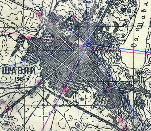
City Šiauliai (Lithuania) on map of west border space of Russian Empire (scale 1:42000).


Pilviškiai map

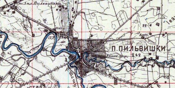
City Pilviškiai (Lithuania) on map of west border space of Russian Empire (scale 1:42000)


Liublin mapa

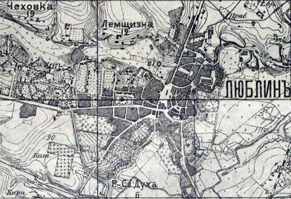
City Lublin (Poland) on map of west border space of Russian Empire (scale 1:42000), Lublin na mapie imperium Rosyjskiego (1:42000).


Siedlce mapa

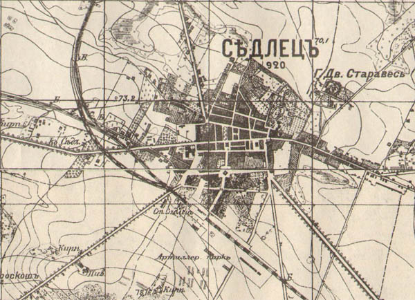
City Siedlce (Poland) on map of west border space of Russian Empire (scale 1:42000), Siedlce na mapie imperium Rosyjskiego (1:42000).


Minsk on map

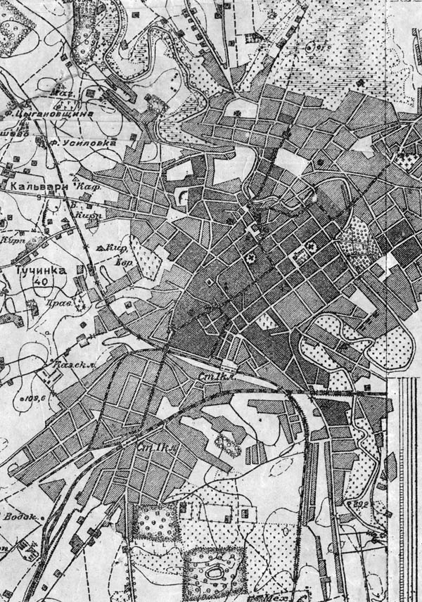
Minsk (Belarus) on map of west border space of Russian Empire (scale 1:42000), 1908

Updated in 12 APR 2013.

Map LXXVII-16 Kriemok of catalog 1:42000 (one werst) maps
As example map LXXVII-16 Kriemok of catalog 1:42000 (one werst) maps. Republishing.
Fragmant of map LXX-A
Fragment of map LXX-A (one werst maps of Russian Empire). Comparison of the maps in scale 1:42000 (one werst map of Russian Empire), 1:84000 (two werst map of Russian Empire), 1:50000 (Red Army) and 1:100000 (Karte des westlichen Russlands). Fragments resized.
One werst maps (1:42000) on territory Crimea.

To collection we add 85 one werst (1:42000) maps on territory Crimea. Maps were based on original topographical picture and were published in 1886-1896.

Index sheet.

index sheet one werts maps 1:42000

Index sheet one-werst (1:42000) maps over territory of Estonia.
Maps of Russian Empire in scale 1:42000 (one verst per inch) orig. named Одноверстовая карта западного пограничного пространства (1-verst maps of west border space) were prepared and published from 1880 till First World War (WW I). In independence (from 1917) Finland, Estonia, Latvia... using 1-verst maps (as maps in other scale) prepared and published ovw maps (recognizing was used). 
Map scale 1:42000 (north zone), covering present Finland, Estonia, North of Latvia, border between Russia and Estonia, Latvia were numbered by Roman and Arabic numerals. First - Roman or Arabic - indicates the number of latitude's line, the second - Arabic number - indicates position sheet in row (see index sheet).

1-verst map
Index sheet of maps of Russian Empire in scale 1:42000 (one verst per inch) orig. named Одноверстовая карта западного пограничного пространства (1-verst maps of west border space), North zone, territories of Estonia, south Finland, north Latvia, border between Russia and Estonia.
The size of maps in scale 1:42000 (north zone) is 6' longitude and 12’ latitude. Longitude considered from Pulkovo.

Tallinn, Ревель
Fragment of 1-verst (1:42000) map showing Tallinn (Ревель), survey 1899, map 3-29

Maps covering former gubernia Liflandia (south of Estonia, north of Latvia) have size and name construction as maps from central zone (see description above), on index these maps marked in dark blue. As alternative maps from this subset were named consistently from 1 till 95. It is interesting that German topographers used these 1-verst maps and republished set in scale 1:50000 practically without changes in content of maps (place names were transcripted into German). More about WWI period German maps in scale 1:50000 THERE.

1-verst maps of west border space
Index sheet of 1-verst (1:42000) maps of west border space of Russia Empire on Liflandia gubernia (sout Estonia, NW Latvia)

Riga
Fragment of 1-verst map (1:42000) showing Riga (Рига), survey 1905, map published in 1915

1:42000
Index sheet of maps of Russian Empire in scale 1:42000 (one verst per inch) orig. named Одноверстовая карта западного пограничного пространства (1-verst maps of west border space), North zone, territories of Finland, Karelia, RF (surroundings Sankt Petersburg). 

Updated on 12 DEC 2013
Index of Map of St.Petersburg and Vyborg province in scale 1:42000, 1858-1870

Map of St. Petersburg and Vyborg province in scale of one mile per English inch (1:42000, 1 cm-420 m), composed of old old cartographic material updated by new survey. Name in original (RU) - Карта Санкт-Петербургской и Выборгской губернии масштабом 1 верста в английском дюйме. Set of maps was issued in 1858-1870. Maps printed in collor, content is displayed in black, forest, grassland, arable land - shades of green, water - blue, large blocks of settlements - in red. The relief shown by shading.

St.Petersburg map

Fragment of Map of St. Petersburg and Vyborg province in scale of one mile per English inch (1:42000), 1858. Part of city St.Petersburg

Map of St. Petersburg and Vyborg province consists of apr. 60 maps (available maps in maps4u.lt collection on index shown in blue).

Languages, Kalbos, Языки
I like maps4u.lt
Login
Username

Password


Not a member yet?
Click here to register.

Forgotten your password?
Request a new one here.
Google
Counter
Hey.lt - Nemokamas lankytojų skaitliukas
Render time: 0.05 seconds 3,732,442 unique visits