Topographical map of Vilnius gubernia (administrative unit) in scale 1:210000 (5 verst per inch), 1836
On beginning of XIX c. Russian topographers agreed that for preparing accurate maps of Russian Empire precise triangulation is needed. First maps that prepared Russians topographers were: 100 sheet map of Russian Empire (1801-1805, scale 1:840000/20 verst per inch, compilers�Карл Иванович, Jan Pieter van Suchtelen), Detailed military map along Russian-Prussian border (1799, scale 1:420000/10 verst per inch). These maps weren't based on triangulation (especially on territories of Russian Empire). Surveyor general Karl Tenner in Vilnius gubernia (administrative unit of Russian Empire) in 1815 began first triangulation in Russian Empire. Work took till 1821. It was measured 3 basis (Driviaty, Pandelis, Palanga), 115 triangles, 98 points (see schema below). F.G.V.Struve in y. 1816-1855 used triangulation of K.I.Tenner to measure geodetic arc of Struve.
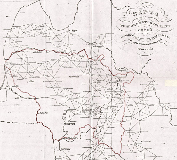
Schema of Tenner's triangulation 1815-1821
Parallel to triangulation in 1819 survey of Vilnius gubernia started. �Vilnius gubernia covered about 65 t. square kilometers, this territory was pictured on 658 sheets of plan-tables in scale 1:21000 (half verst per inch). Each plan-table had dimension 20x20 inch, relief was showed by shading according Lehman scale. Parallel with plan-tables were half-originals in scale 1:42000 and description of Vilnius gubernia prepared. Unfortunately, plan tables in scale 1:21000 and half-originals in scale 1:42000 weren't published, exception one map in scale 1:42000 covering Vilnius and surroundings (see below).
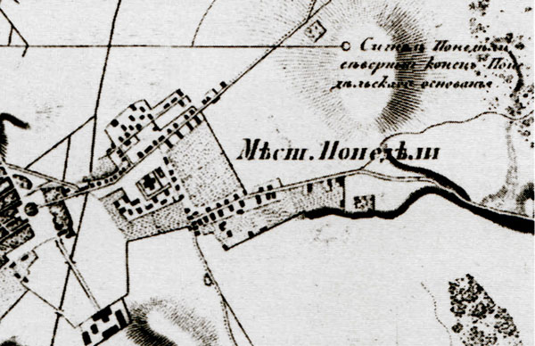
Fragment of plan-table of Tenner survey of Vilnius gubernia (surrounds of Pandelis city, Lithuania)
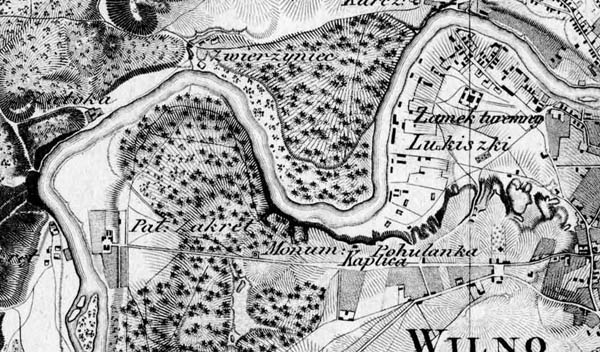
Fragment of half-original in scale 1:42000 of Tenner survey of Vilnius gubernia (surrounds Vilnius)
All Vilnius gubernia (administrative unit) was shown on map, prepared using Tenner survey, published at first in 1836. Scale of this map was 1:210000 (5 verst per inch). maps consists of 8 sheets, each 63x53 cm, separately published index sheet. Maps originally named "Топографическая карта Виленской губернии, составлена в 1:210000 долю настоящей величины со съемки генерал лейтенанта Теннера, гравирована при военно-топографическом депо MDCCCXXXVI" (Map of Vilnius gubernia, published in scale 1:210000...).
After administrative reform of Russian Empire in 1842-1843 when Vilnius gubernia was divided into kaunas and Vilnius gubernia and several administrative units of Minsk and Grodno gubernia were linked to Vilnius gubernia map in 1845 was republished and renamed to "Топографическая карта Виленской и Ковенской губерний..." (Map of Vilnius and Kaunas gubernia...). This set consists of 11 maps (see index sheet below).
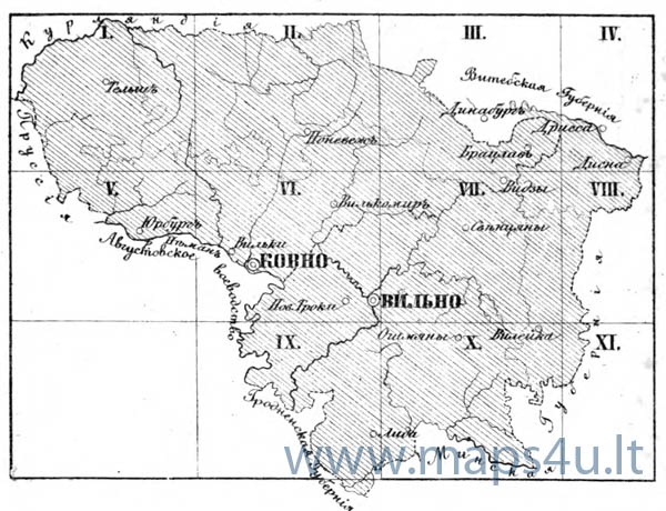
Index sheet of�map of Vilnius and Kaunas gubernia, 1:210000, 1845.
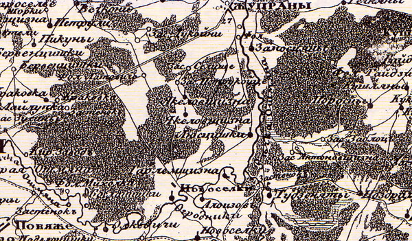
Fragment of Vilnius gubernia map, scale 1:210000, 1836
Literature:
1. "Каталог карт, планов, атласов, медалей, эстампов, книг и геодезических инструментов", составленных, гравированных и изготовленных в военно-топографическом депо Главного Штаба ЕИВ..., 1858.


