| 10 MAR 2013 |
 |
Chapter of Austrian maps was supplemented by description of Map of Middle Europe in 64 sheets (original title Charte der von Mitteleuropa in 64 Sectionen entworfen, von Joseph Marx Freiherrn von Lichtenstern), 1807-1813. |
|
· admin on 2013-03-10 10:34:33
Read More ·
1957 Reads ·

|
| 23 FEB 2013 |
 |
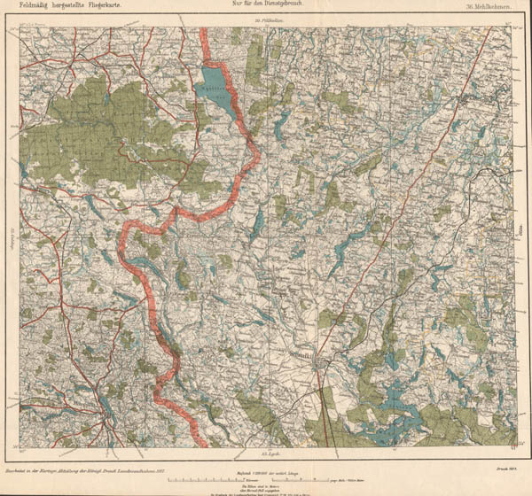
Chapter of German WWI maps in scale 1:25000 Russischen karte des Westlichen Grenzgebiets (Russian map of western frontier) supplemented by new information. Set covers territories from S.Petersburg and Estonia in North to West Ukraine in South, from front line in 1918 (west Belarus) in East to Baltic see in West. Interesting that preparing maps from this set German topographers use not only Russian verst maps but also made original survey... |
|
· admin on 2013-02-24 12:32:05
Read More ·
2022 Reads ·
|
| 2013 02 12 |
 |
New information and maps supplemented chapters of German maps in scale 1:200000 (Reymann's Karte, Feldmässig hergestellte Fliegerkarte, Topographische Übersichtskarte des Deutschen Reiches) and chapter of Russian maps in scale 2 verst per inch (1:84000, set Two-verst map of west borderland of Russian Empire orig. named Двухверстовая карта западного пограничного пространства). |
|
· admin on 2013-02-12 11:12:51
Read More ·
2038 Reads ·
|
|
 |
| 2013 01 24 |
 |
Chapter PLANS OF CITIES of INTER-WAR LITHUANIA (1918-1940) was supplemented by description of Common plan of squares, contoures and streets of city Panevėžys with relief shown by horizontals (1934, 1:2500). Plan was prepared by civilian workers (engineers) and officers of Military Topography Department of General Staff of MoD. |
|
· admin on 2013-01-24 12:37:34
Read More ·
1950 Reads ·
|
| 2013 01 21 |
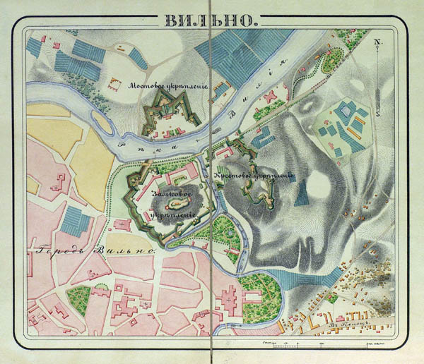 |
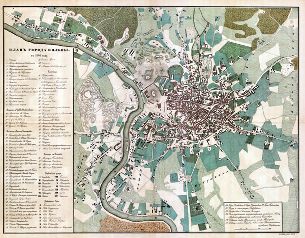
Chapter ATLASES OF RUSSIAN EMPIRE was supplemented by description of two statistical atlases and description of Atlas of fortresses of Russian Empire's Army (1830-1840). Map of fortress Vilnius presented in full size... |
|
· admin on 2013-01-21 10:45:33
Read More ·
1928 Reads ·
|
| 2013 01 15 |
 |
Chapter of Inter-war Lithuania (1918-1940) aerial photos was supplemented by few aerial photos of city Kaunas showing territories of valley Mickevičius and surroundings: now territories around streets Vydūno, Radvilėnų, Skroblų, Šviesios, Slėnio, Basanavičiaus also present territories of Faculty of chemical technology of KTU, Zoo, also part old city, confluence of rivers Nemunas and Neris... |
|
· admin on 2013-01-15 12:51:02
Read More ·
2073 Reads ·
|
|