Vilnius city and surroundings 1:5000, 1978-1979
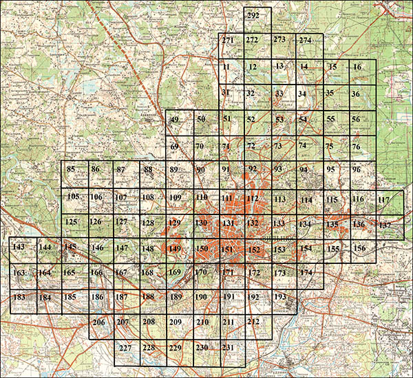
Main Administration of Geodesy and Cartography (Главное управление геодезии и картографии) in 1979-1980 issued the set of maps in scale 1: 5000 (1sm. 50 m.) on the Vilnius city and its surroundings. Map developed using topographical survey from y. 1974-1979. Set consists of 119 maps, maps were numbered from 11 to 292 (see index sheet). Maps have dimensions with frame 48x54 cm (content - 40x40 cm). The main part of maps (111 maps) issued in 3 colors - content is displayed in black, horizontals - brown, water - blue, 8 maps issued in one color - black displays all the content of the map. Relief was shown by contours at intervals of 1 m. Height system - Baltic. Coordinate System - local. Set of maps was issued by company Number 5. At frames was given following information: coordinate system, the publisher, the title and sheet number, security classification ( "Secret"), the year of topographical survey, scale, elevation system, index sheet. Military and strategic facilities on the map were masked by inserting false fragments.

Index sheet of set maps in scale of 1: 5000 (1sm. 50 m.) on Vilnius city and its surroundings, 1978-1979
General view of the map 191, set of maps in scale 1: 5000 (1sm. 50 m.) on Vilnius city and its surroundings, 1978-1979
Fragment of map No.131, set of maps in scale 1: 5000 (1sm. 50 m.) on Vilnius city and its surroundings, 1978-1979. Shown area near Cathedral and mountain Gediminas’ Castle.

