Index sheet digitalized RKKA maps in scale 1:50000 (link)
RKKA maps in scale 1:50000 were produced since the early 1930's. The content of the first RKKA maps in scale 1:50000 was moved from older maps (German maps in scale 1:25000, Russian empire maps in scale 1:21000, 1:42000), it was used original survey, maps later editions have been updated according available cartographic material (Polish, Latvian, Lithuanian, Estonian topographic maps).
RKKA maps in scale 1:50000 were composed in the 1931 year coordinate system. Coordinates were calculated in 6 degrees areas of Gauss-Kruger projection, using parameters of Bessel ellipsoid. Frames of maps have size - 10' latitude and 15' longitude, which is considered from Greenwich.
On maps was drawn kilometer grid, minutes frames.
Relief was shown by horizontals every 10 m.
Maps were printed in two or four colors. Till WWII RKKA topographers made and published two editions of RKKA 1:50000 maps (on Lithuania territory).
Abbreviation RKKA means - Рабоче-крестьянская Красная армия (in Russian), Workers' and Peasants' Red Army (in English).
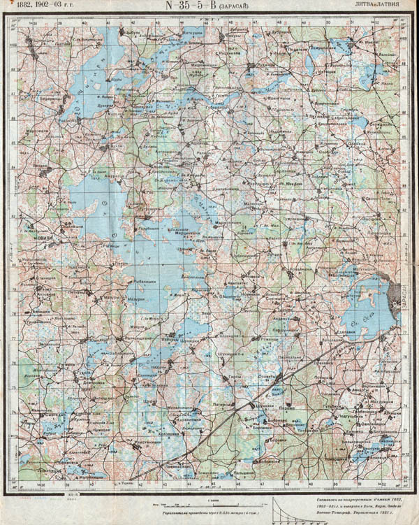
RKKA map in scale 1:50000 N-35-5-В (N-35-5-C) Зарасай, 1931 (first edition). General view
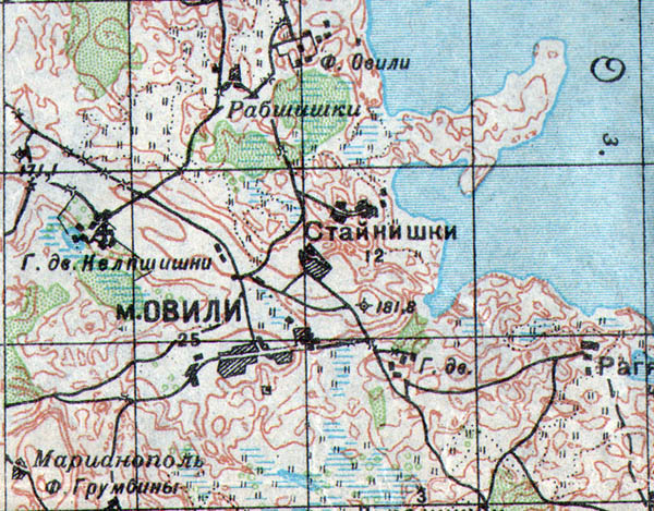
RKKA map in scale 1:50000 N-35-5-В (N-35-5-C) Зарасай, 1931 (first edition), fragment showing village Aviliai (Zarasai District.)
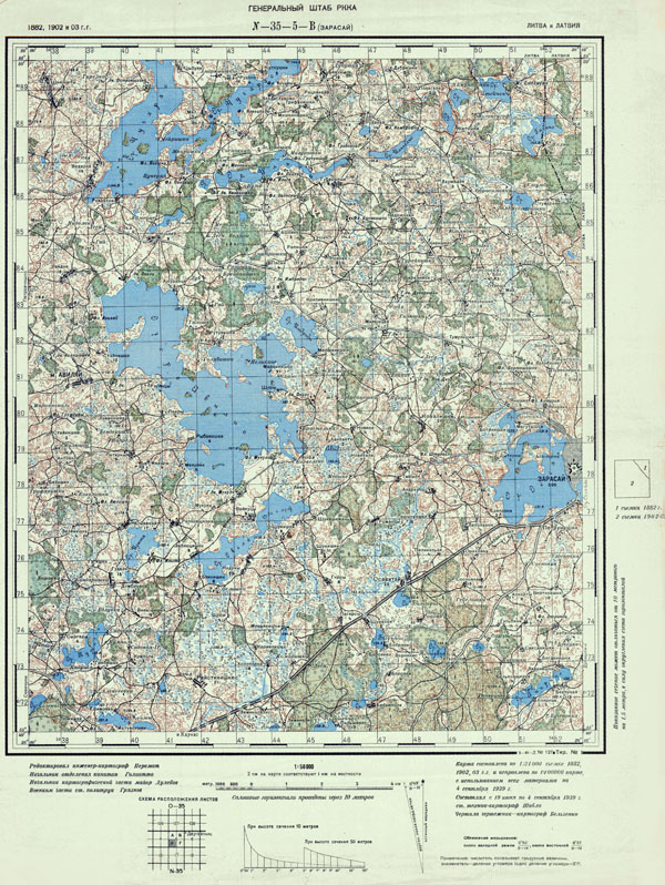
RKKA map in scale 1:50000 N-35-5-В (N-35-5-C) Зарасай, 1940 (second edition). General view
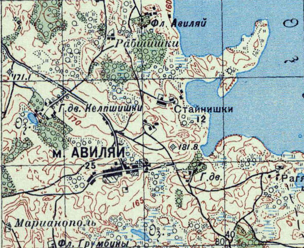
RKKA map in scale 1:50000 N-35-5-В (N-35-5-C) Зарасай, 1940 (second edition), fragment showing village Aviliai (Zarasai District.)