Soviet maps in scale 1: 300000 (1cm. 3 km.)
Soviet maps in scale 1: 300000 (1 centimeter on map - 3 kilometer in area) is made by dividing the international map in scale 1: 1000000 (1 cm-10 km.) into 9 parts (see below). Name of maps in scale 1: 300000 constructed by the addition of a Roman number (in front) to the title of 1: 1000000 map. Roman number indicates the position of the map in scale 1: 300000 on the map in scale 1: 1000000. In addition to the name of the map scale 1: 300000 added the name of the largest settlement on the map. Example of name of map in scale 1:300000: VI-N-34 Grodno.
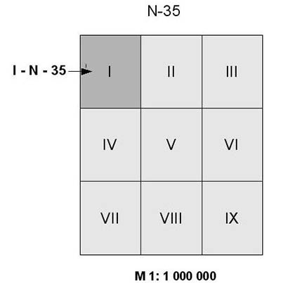
Size of the maps in scale 1: 300000 - 1° 20’ latitude x 2° longitude. Longitude is measured from Greenwich. Relief displayed by contours every 20 meters. On the frame of maps presented symbols and abbreviations, administrative division, scale, hypsometric chart and notes. On the maps in scale 1: 300000 displayed only the territory of the USSR, the territory of neighboring states - white spots.
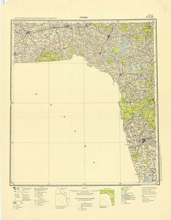
General view of map in scale 1: 300000 - map VI-N-34 Grodno, 1970


