1:1000000 (1 cm - 10 km) soviet maps (International World Map)
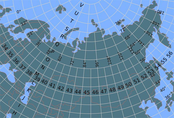
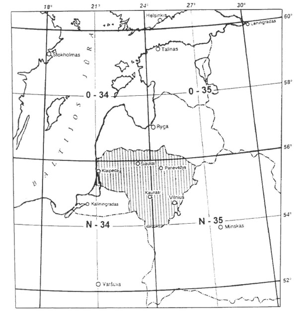
Principles of drawing the International world map in scale 1:1000000 (Carte internationale du monde au 1:1000000) were installed in the cartographic conference on the eve of the First World War in 1913, in Paris. Each map sheet covers an area of 4 ° in latitude and 6 ° of longitude. Above 60° latitude permitted compound sheets by two or more together. On either side of the equator to 88° latitude 4-degree zones denoted by Latin letters from A to Y. The circles around the poles, limited 88° latitude, denoted by the letter Z. Columns at 6 ° of longitude are numbered from 1 to 60 from west to east, starting with the 180° meridian of Greenwich. Each sheet, except for the nomenclature, the naming is in a major location or geographic area. Each sheet signed in French "Carte Internationale du Monde au 1000000-e" and the same inscription in language publisher of the paper. All sheets are published in the paper the same size (80 * 65 cm). International Map of the World Lithuania displays on sheets O-34, O-35, N-34, N-35. Soviet topographers changed rules of preparing map in scale 1:1000000- all place names on soviet 1:1000000 maps given in Cyrillic alphabet.

Index of soviet maps in scale 1:1000000 (International map) on territory of former UdSSR

Lithuania territory on international map.Lithuania is situated on the sheets 0-34, 0-35, N-34 and N-35

Example (general view) of soviet map in scale 1:1000000 N-35 Минск-Вильнюс, 1989

