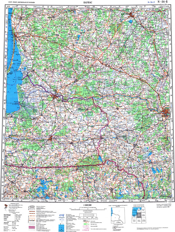
Topographic map in scale 1:500000 (1 cm-5 km.)
By quartering the
international map in scale 1:1000000 (Carte Internationale du Monde au 1:1000000) come a
map in scale 1:500000 (1 cm - 5 km.). 1:500000 scale map sheets have a trapezoid shape, size 2 degrees latitude by 3 degrees longitude. Longitude considered from Greenwich. Projection - modified polygon. On the map sheets in scale 1:500000 network held every 30' latitude and every 20' longitude. Relief displayed by contoures every 50 meters. Map sheets are numbered according to the international map in scale 1:1000000 by adding the Cyrillic letter A, Б, В, Г (A, B, V, G) indicating the position (quarter) and the name of the largest population place on the map. Name Example: N-34-Б Каунас. Parallel to the name as mentioned above used manes instead of the letter indicating the position of the sheet to use a 1-4 digit, for example N-34-2.
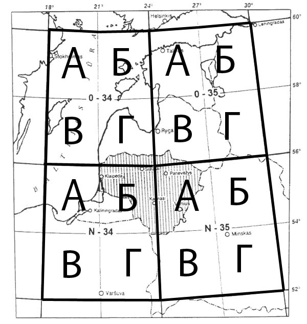
Schema showing position of maps in scale 1:500000 on territories of Estonia, Latvia and Lithuania. Territory of Lithuania is covered by maps О-34-Г, O-35-В, N-34-A, N-34-Б, N-34-Г, N-35-А, N-35-В (1:500000).
General view of map in scale 1:500000 N-35-Б Каунас, 1988 (Territory of part Lithuania, North Poland, part Kaliningrad region RF)